West Arnhem Land
Map
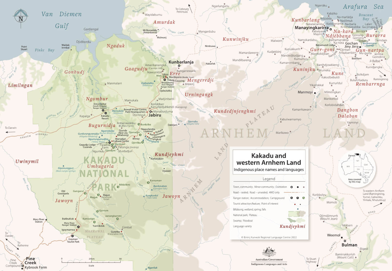
A map of West Arnhem Land created by the language centre. You can find a hi-res version below.
Hi-res map: a2-kakadu_and_western_arnhem_land_high_res.pdf.
Stone Country
Kunwardde (Stone country)
Stone arrangements
Kare birri-ngale birri-warddeyirrikurrmeng? Dabbarrabbolk dja kare djang kurrmerrinj. Minj na-ngale ka-bengkan. Mahni kun-wardde ka-yirriyo birri-ngalkeng nawu Warddeken Rangers kore na-Warddjak kun-red bedberre.
Who arranged the stones like this? Perhaps some were made by our ancestors, and perhaps some are Dreamings that placed themselves there. Nobody knows. The Warddeken Rangers found these stone arrangements in Warddjak clan territory.
Historical images
Bim nawu Bimmey Herbert Basedow (Photos by Herbert Basedow)
Mahni bim nakudji Balanda nayuhyungki 1928 kumwam kore Kuninjku kunred bedberre wanjh benbimmey dabbarrabbolk dja kunwarddebim kore Marrngunj dja Kunumidjarda. Yinan korroko bimmakni la bolkkime kabimngarlangarlhme.
The black and white photos here were taken by Herbert Basedow in 1928 in Kuninjku country. In these images you can compare Herbert Basedow's photographs of rock art taken in Kuninjku country in 1928 with images of the same sites taken in 1998. You can see the extent of the deterioration in only 70 years. The sketch of the image at Marrngunj was made by Basedow and appeared in the Brisbane Courier Mail, September 5, 1928. For more about Basedow see:
Kaus, David. 2008. A Different Time: The Expedition Photographs of Herbert Basedow 1903-1928. Canberra: National Museum of Australia Press.
Garde, Murray and Kohen, Apolline. 2004. Putting Herbert basedow back in focus; the 1928 expedition to Arnhem Land. Australian Aboriginal Studies 1: 26-36.